ECE 297 Project by Defne, Sarhad and Zeng
A GIS which features:
- line distance
- live search
- weather API
- night mode
- keyboard shortcuts
- hover box
- POI highlight

Zoom in
Click this button to zoom in, or double click the map, or use mouse scroll button.
Shortcut = Ctrl + +

Zoom out
Click on this button to zoom out, or use mouse middle click.
Shortcut = Ctrl + -

Zoom fit
Fits your map to the screen.
Shortcut = Ctrl + O

Help
Click on this button to get help about available buttons and the interface.

Find distance
Click on this button to enable line distance feature, click on the map to start drawing and the map will display the distance between the connecting points. The distance will be written over the lines between selected points.

Night mode switch
Click on this button to enable night mode. Return to day mode by clicking again.

Shutdown
Click on this button to shutdown.
Mouse panning
Click on the arrow pointing in the direction you want to pan.
Shortcuts:
W = UP
A = left
S = down
D = right

Double click
Double click on the map to see the closest point of interest or intersection.

Website pop-up
When a website is available for a point of interest, click on this button to go to their website.

Weather
We use Open Weather Maps to obtain weather API data.
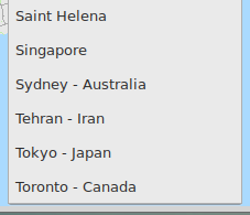
City scrollbar
Click on the city scroll bar and double click on the city you would like to view.
City scrollbar
Click on the city scroll bar and double click on the city you would like to view.